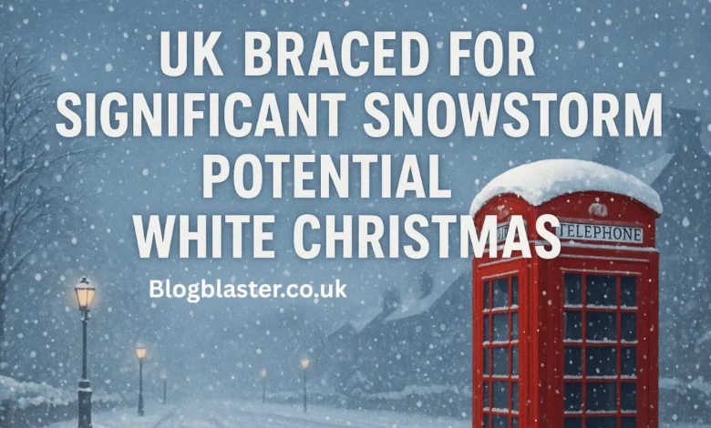
As the festive season approaches, weather watchers and winter dreamers across the United Kingdom are keeping a nervous eye on the skies. Headlines are now warning that the UK is braced for a significant snowstorm bringing a potential White Christmas. But how realistic is this scenario, and where might it materialize? In this in-depth article, we explore the latest forecasts, meteorological drivers, regional chances, and what a “White Christmas” really means in UK weather parlance.
What Is a White Christmas? The Official Definition
Before diving into forecasts and snowstorm models, it’s essential to clarify what constitutes a White Christmas. Under the Met Office’s criteria, a White Christmas is declared when at least one snowflake is observed falling anywhere in the UK over the 24 hours of 25 December, as recorded by an official Met Office observer or automated weather station.
That means even a single flurry — especially in a remote or high altitude location — qualifies. It does not require widespread snow cover or heavy accumulations.
When we think of a “picture-perfect” Christmas with deep snow blanketing towns and fields, that is much rarer. Widespread lying snow (e.g., snow on the ground at many stations at 9 am) has occurred only a handful of times since 1960.
The Forecast Outlook: What the Met Office and Others Say
Long-Range and Seasonal Signals
The Met Office publishes long-range forecasts that extend over weeks and months, giving broad trends in temperature and precipitation rather than precise daily predictions.
Their long-range outlook covering December and the Christmas period does include the possibility of colder and wintry spells. Still, it clearly states that detailed, location-specific forecasts only become reliable about five days before the date.
In their seasonal outlooks and 3-month forecasts, the Met Office factors in large-scale climate drivers (such as La Niña, jet stream patterns, North Atlantic pressure anomalies). These drivers can slightly tilt the odds toward colder or wetter patterns, but do not guarantee a snowstorm will occur months ahead.
What Media and Independent Forecasters Are Reporting
A variety of media outlets, weather blogs, and independent forecasters have picked up on model runs suggesting a potential snowstorm sweeping across parts of the UK in the run-up to Christmas. For example, headlines such as “UK Braced for Significant Snowstorm Bringing Potential White Christmas” have appeared.
That said, many articles also carry cautionary caveats: that changes in pressure systems or freezing levels could make or break the snow threat, and that snow will “most likely be limited to high ground” with only lower zones sometimes touched under favorable conditions.
The Independent, for instance, reminds readers that while snow is possible in colder interludes, it is not until the final week before Christmas that the Met Office can reliably state whether snow will fall.
Another recent article suggests that, despite speculation, many forecasters remain cautious about a full-blown snowstorm, citing the typical dominance of mild air from the Atlantic.
Thus, the narrative is: yes, there is potential — but with significant uncertainty until closer to the time.
Meteorological Conditions That Could Favor a Snowstorm
To determine whether the scenario is plausible, it is helpful to examine the physical and atmospheric conditions necessary for snow in the UK, particularly in December.
Cold Air Advection
One essential element is cold air — typically from the north or east. Northerly or easterly winds bring in Arctic or continental air that can lower surface temperatures, creating conditions favorable for snow instead of rain.
However, in many winters, the prevailing air masses come from the Atlantic (southwest to west), bringing milder, moist air that favors rain over snow.
Moisture and Frontal Systems
Cold air alone is insufficient — there must be a moisture source, usually via a frontal system or moist air intruding over a cold layer. If a moisture-laden front meets cold air near the surface (or over a shallow warm layer), snow or sleet may result.
Mountainous or upland terrain can help: uplift forces moist air to rise and cool, triggering snow or wintry showers on hills and mountains first.
Stable Cold Conditions (High Pressure)
Another scenario that can produce persistent low-level cold is when high pressure becomes established over the region, skies clear, and radiative cooling overnight causes ground chill. This tends to favor frost or shallow snow if moisture is available.
But in the UK, this is less frequent compared to milder, unsettled Atlantic regimes.
Forecasting Challenges
Snow forecasting in the UK is notoriously tricky because of the “fine line” between rain and snow for any particular location. A slight shift in the freezing level (even a few hundred meters) can flip precipitation type from snow to sleet or rain.
Due to the UK’s maritime setting and varied topography, long-term snow forecasts are less reliable compared to more continental climates.
Thus, even if models hint at a cold front and precipitation, whether it materializes as a snowstorm before Christmas remains subject to changing conditions.
Where Snow and a Local White Christmas Are Most Likely
Given the challenges, it’s helpful to assess which regions in the UK are most likely to see snow — and thus the potential for a localized White Christmas — if conditions align.
Most Favored Areas
- Scottish Highlands and northern Scotland: High elevations and northerly exposure make this region the strongest candidate for snow or flurries on December 25, especially in the event of a colder pulse.
- Upland areas in northern England, such as the Pennines, and higher parts of Wales: If the airmass is sufficiently cold, snow could spill lower, at least transiently.
- Northern Ireland: Some hill regions may see occasional wintry showers.
- In especially favorable setups, lowland northern England might see sleet or snow flurries.
Less Likely Areas
- Southern England and southeast: These areas are less likely to see snow, unless the cold airmass is unusually strong and persistent, and moisture arrives at the precise time to produce flakes rather than rain.
- Coastal lowlands: The influence of maritime air and slightly warmer conditions generally discourages persistent snow coverage.
Multiple reports caution that snow under a weak cold spell is “likely restricted to high ground,” with lower elevations only occasionally touched.
So even if a snowstorm does occur, much of southern England may remain grey, damp, or rain-washed.
Likely Impacts & Preparations
If a significant snowstorm materializes, the UK could experience several disruptions — although the extent of these disruptions depends heavily on the timing, intensity, and localized freeze conditions.
Travel Disruption
- Roads — mainly rural or hilly roads — may become hazardous or impassable if snow accumulates or sleet freezes overnight.
- Rail services may be delayed or cancelled, particularly in northern and upland areas.
- Airports and flights may experience disruptions or cancellations if snow, ice, or low visibility affects the runways.
Local Services & Utilities
- Power outages may occur if heavy snow brings down branches or lines, causing damage to the electrical system.
- Emergency services may be pressured, especially in more isolated communities.
- Gritting and snow clearance operations will be essential in vulnerable regions, but availability is constrained by lead time.
Public Safety & Awareness
- The public should stay updated on Met Office weather warnings (Yellow, Amber, Red) — these are typically issued a few days before impact.
- Travelers should have a winter kit (including an ice scraper, de-icer, and warm clothing) ready.
- Local authorities, schools, and transport agencies may need contingency plans.
Even a modest snowfall on Christmas Eve can have a significant impact on travel, grocery deliveries, church services, and holiday mobility on Christmas Day.
Historical Context & Trend Toward Milder Christmases
To put the current forecasts into context, it is helpful to review past Christmas weather trends in the UK.
- Since 1960, approximately half of all Christmases have been recorded at least at one location with snowfall (i.e., technically a White Christmas by the Met Office definition).
- However, widespread snow cover on Christmas morning (snow lying across large parts of the country) has been seen only four times since 1960 (1981, 1995, 2009, 2010).
- More recent Christmases often see a flurry or two — but rarely deep snow that transforms landscapes.
- In many recent years, forecasts have leaned toward a “grey” Christmas: overcast, mild, with little snow. For example, media coverage of Christmas 2024 predicted one of the warmest December 25ths on record for the UK, reducing the odds of snow.
In sum, while snow on Christmas Day is not exceedingly rare technically, the dramatic, snowy Christmas of legend is increasingly unlikely in many parts of the UK.
Why This Year’s Snowstorm Talk Attracts Attention
Several conditions have converged to prompt speculation about a snowstorm and White Christmas:
- Model hints — some forecast ensembles are producing cold pulses or fronts in late December in current simulations (though with low confidence).
- Public interest & media — as Christmas approaches each year, the appeal of a White Christmas dominates weather narratives.
- Climatic variability — recent mild winters amplify the surprise factor and hope for something wintry.
- Cautionary messaging by experts — forecasters repeatedly stress that model signals this far out must be taken with caution, fueling debate and curiosity.
So while the speculation is real, it’s part of a broader seasonal cycle of hope, skepticism, and shifting forecasts.
How to Track and Interpret Updates
To better assess the likelihood closer to December 25, follow these guidelines:
- Check the Met Office’s daily and 5-day forecasts — by mid-December, snow threats will be more explicit in their bulletins.
- Watch for weather warnings — the issuance of Yellow, Amber, or Red warnings is often a strong signal of impactful snow or ice.
- Monitor model ensembles — multiple forecast models (e.g., UKMET, ECMWF, GFS) running various scenarios may converge toward a cold/snow pattern if it’s solid.
- Observe freezing-level trends — a lowering of the freezing level (i.e., the altitude where the temperature crosses 0 °C) is crucial; if this drops to low elevations, snow becomes more likely.
- Be cautious about sensational headlines too early — many snowstorm projections this far in advance don’t pan out when the finer-scale conditions resolve.
As the Met Office notes: “It is impossible to determine an ‘exact date’ for the arrival of snow in the United Kingdom weeks in advance.”
Final Take: A Snowstorm Is Possible, But Far From Certain
Yes — the UK could be braced for a significant snowstorm bringing a potential White Christmas, especially in northern and upland regions. But at present, that scenario remains speculative rather than confirmed. The multiple caveats and conditional language in forecasts reflect the inherent unpredictability of snow in the UK.
You May Also Read: Louise BBC Weather: The Inspiring Journey of Louise Lear at the BBC